NASA Global Hydrology and Climate Center Interactively zoom and animate weather satellite images from a variety of geostationary satellites. Features include user selectable point and click sectoring, animation, a variety of map overlays, zoom levels, and map colors. http://wwwghcc.msfc.nasa.gov/GOES/ Nasa.gov~Site InfoWhoisTrace RouteRBL Check
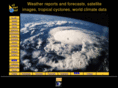
Weather satellite images Real time images from polar orbiting satellites (NOAA)and geostationary satellites (Meteosat, GOES, GMS, FY-2). Global coverage. Hurricanes and tropical storms tracking. Tutorial on the image interpretation and satellite description. http://www.allmetsat.com/ Allmetsat.com~Site InfoWhoisTrace RouteRBL Check
Dallas Remote Imaging Group Dallas Remote Imaging Group (DRIG) provides consulting services on weather satellite imagery, satellite tracking, and the use of image acquisition and processing in education. http://www.drig.com/ Drig.com~Site InfoWhoisTrace RouteRBL Check